
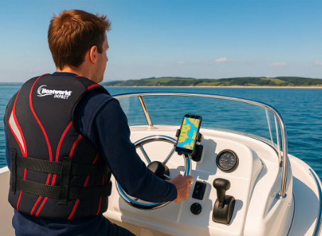
For boaters, understanding tides and currents is just as important as plotting a course. Rising and falling tides can transform safe passages into hazards, while strong currents can significantly impact fuel efficiency. Modern marine apps have stepped in to help mariners manage these challenges. If you’re exploring local waters, a canadian marine navigation app can provide detailed tide and current predictions tailored to your region. Combined with trusted resources like tide tables from Fisheries and Oceans Canada, these apps make planning and navigation much safer and more efficient.
Why Tides and Currents Matter?
For centuries, sailors have relied on tides for safe navigation. A channel navigable at high tide may be impassable at low tide, and anchoring without considering tidal shifts can lead to grounding. Currents, meanwhile, influence travel speed and fuel consumption. Understanding their direction and strength is critical for timing departures, planning fishing trips, and ensuring safe docking.
Digital navigation tools now make this information more accessible than ever, integrating tide and current predictions directly into interactive charts.
How Marine Navigation Apps Handle Tide Data?
Marine navigation apps combine several data sources and technologies to deliver accurate tidal predictions:
- Official Tide Stations
Apps pull data from government tide stations, which provide long-term forecasts based on lunar cycles, atmospheric pressure, and historical patterns. - Graphical Displays
Instead of flipping through a tide table, users can view simple graphs or colour-coded overlays that show high and low tides for the day or week. - Real-Time Adjustments
Some apps refine predictions with local real-time data, improving accuracy during unusual weather conditions. - Route Planning Integration
Tide predictions are often linked directly to route planning. For example, the app may warn if your planned departure coincides with low tide in a shallow channel.
How Apps Manage Current Predictions?
Currents are more complex than tides, influenced by wind, geography, and the movement of water. Here’s how apps address them:
- Hydrodynamic Models
Many apps incorporate advanced oceanographic models that simulate water flow patterns, offering predictions of current strength and direction. - Overlay on Digital Charts
Currents often appear as arrows on the map, with size or colour indicating strength. This allows boaters to visualise how currents will affect their course. - Integration with GPS and AIS
Apps can compare predicted currents with actual vessel speed and position, adjusting navigation advice in real-time. - Time-Specific Forecasts
Just like tide predictions, current forecasts are broken down by hour, making it easier to plan when to take advantage of favourable flows.
Popular Apps with Strong Tide and Current Features
Navionics
Navionics overlays tide and current stations directly onto its charts. Users can tap on a station to view hourly predictions, which helps with both fishing and safe passage planning.
C-MAP
C-MAP offers high-resolution tidal and current data integrated into its charts, with custom depth shading for areas impacted by tidal changes.
Aqua Map
Aqua Map features tidal graphs and current overlays, as well as the ability to download data for offline use, which is particularly essential in remote areas.
iNavX
iNavX supports various chart formats and integrates tidal predictions from NOAA and other official data providers, making it flexible for boaters in multiple regions.
Practical Scenarios Where These Features Matter
- Crossing an Inlet: A boater planning to cross a coastal inlet can check the app for tide levels to avoid shallow water at low tide.
- Fuel Efficiency: Sailors on long voyages can time their trip to align with the current, rather than against it, thereby conserving fuel and time.
- Fishing Trips: Many species are more active during specific tidal movements. Apps allow anglers to align outings with favourable conditions.
- Docking and Anchoring: Predicting currents ensures safer docking maneuvers and prevents anchors from dragging on the seabed.
Balancing Tech with Local Knowledge
While apps provide invaluable information, seasoned mariners recognise the importance of combining predictions with on-the-water experience and awareness. Local conditions, such as sudden weather shifts or river inflows, can alter currents in ways that models can’t fully anticipate. That’s why apps work best when paired with observation and experience.
Conclusion
Marine navigation apps have transformed how boaters handle tides and currents. By combining official tide tables, advanced current models, and user-friendly interfaces, these apps simplify complex data into actionable insights. Whether planning a fishing trip, a long voyage, or a simple harbour crossing, tools like a Canadian marine navigation app offer the guidance needed to sail safely and efficiently in ever-changing waters.